Hema Top End and Gulf Regional Map #8 (Min Order Qty 1)
Special Price
$8.18
Regular Price
$9.09
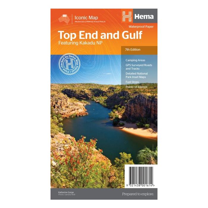
This regional waterproof map of the Top End and Gulf is ideal for discovering the northern parts of Australia's NT by 4WD. It includes a main map of the Darwin region, Judbarra / Gregory National Park, Nhulunbuy, Keep River National Park and Boodjamulla (Lawn Hill) National Park.
There is additional tourist information for Arnhem Land, the Roper River trek, Darwin region, Douglas-Daly district, Nature’s Way, Victoria Highway, Katherine Region and the Stuart Highway Region.
Key Features
•GPS surveyed roads and tracks
•Fuel stops
•Self-drive 4WD tracks
•Camping areas
•Historic sites
•Detailed National Park inset maps
•Waterproof paper
Size 25x14x3cm folded
Size 83.5 x 50 cm unfolded
Min Order Qty 1
Firm Sale
Additional Information
| SKU | 00161 |
|---|---|
| RRP | 15.99 |
| Restricted Sales | FIRM SALE |
| Status | Non Returnable |
| APN | 9321438001614 |